


VTD-precinct A7, Marshall County, South Dakota
About
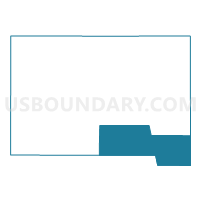
Outline

Summary
| Unique Area Identifier | 667531 |
| Name | VTD-precinct A7 |
| County | Marshall County |
| State | South Dakota |
| Area (square miles) | 108.23 |
| Land Area (square miles) | 89.16 |
| Water Area (square miles) | 19.07 |
| % of Land Area | 82.38 |
| % of Water Area | 17.62 |
| Latitude of the Internal Point | 45.61956690 |
| Longtitude of the Internal Point | -97.41937990 |
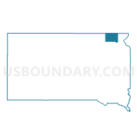
Maps

Graphs
Select a template below for downloading or customizing gragh for VTD-precinct A7, Marshall County, South Dakota


Neighbors
Neighoring Voting District (by Name) Neighboring Voting District on the Map
- VTD - precinct 10 - OneRoad-GoodwillTwps, Roberts County, SD
- VTD precinct A9, Marshall County, SD
- VTD- precinct 11 - DrywoodLake-Enterprise-Grant-LongHollow-SissetonTwps, N&E of Sisseton town, Roberts County, SD
- VTD-precinct A4, Marshall County, SD
- VTD-precinct A6, Marshall County, SD
- VTD-precinct GK-GrenvilleTown-Gren-KosciuskoTwp, Day County, SD
- VTD-precinct RR- Raritan-Liberty-Nutley-RoslynTwn, Day County, SD
Top 10 Neighboring County Subdivision (by Population) Neighboring County Subdivision on the Map
- Long Hollow township, Roberts County, SD (323)
- Red Iron Lake township, Marshall County, SD (201)
- Lake township, Marshall County, SD (173)
- Kosciusko township, Day County, SD (167)
- Dry Wood Lake township, Roberts County, SD (129)
- Buffalo township, Marshall County, SD (114)
- Eden town, Marshall County, SD (89)
- Eden township, Marshall County, SD (85)
- Nutley township, Day County, SD (70)
- Sisseton township, Marshall County, SD (67)
Top 10 Neighboring Place (by Population) Neighboring Place on the Map
Top 10 Neighboring Unified School District (by Population) Neighboring Unified School District on the Map
- Sisseton School District 54-2, SD (7,853)
- Britton-Hecla School District 45-4, SD (3,149)
- Webster School District 18-4, SD (3,038)
- Langford School District 45-2, SD (1,195)
- Roslyn School District 18-2, SD (735)
Top 10 Neighboring State Legislative District Lower Chamber (by Population) Neighboring State Legislative District Lower Chamber on the Map
Top 10 Neighboring State Legislative District Upper Chamber (by Population) Neighboring State Legislative District Upper Chamber on the Map
Top 10 Neighboring 111th Congressional District (by Population) Neighboring 111th Congressional District on the Map
Top 10 Neighboring Census Tract (by Population) Neighboring Census Tract on the Map
- Census Tract 9508, Marshall County, SD (4,656)
- Census Tract 9408, Roberts County, SD (2,862)
- Census Tract 9529, Day County, SD (1,919)
- Census Tract 9527, Day County, SD (1,682)
Top 10 Neighboring 5-Digit ZIP Code Tabulation Area (by Population) Neighboring 5-Digit ZIP Code Tabulation Area on the Map
- 57262, SD (4,963)
- 57430, SD (2,243)
- 57454, SD (558)
- 57261, SD (321)
- 57247, SD (320)
- 57232, SD (299)
- 57239, SD (223)